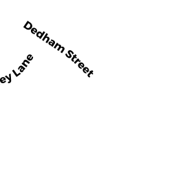
439 DEDHAM ST 439-D4
Owner Information
GLAZER MICHAEL H
439 DEDHAM ST UN D4
NEWTON, MA 02459


Property Details
439 DEDHAM ST 439-D4 is classified as a Residential Condominium (Townhouse).
The primary structure on this property was built in 1980. There are 4,926ft2 of built area within this property. There is 2,974ft2 of residential/living space within this property. This property is listed as having 8 rooms.
439 DEDHAM ST 439-D4 is valued at $1,579,000. The land is valued at $0 and the structures are valued at $1,579,000.
This property is in Zone MR1. Confirm with local Zoning Board authorities to ensure there are no overlays or other easements on this property.
The most recent deed for 439 DEDHAM ST 439-D4 is recorded at the local registrar in Book 149, Page 76. 439 DEDHAM ST 439-D4 was last sold on Tuesday, May 15, 2018 for $1,280,000.
Assessment data from fiscal year 2022.
Flood Data
According to the FEMA National Flood Hazard Layer, this property does not appear to be in a flood zone. It may also be in an area not yet reviewed. Nonetheless, confirm this information prior to taking any action.
To view the flood hazards around this property, create a FEMA "Firmette" Map of the area around 439 DEDHAM ST 439-D4.
Broadband Internet Providers
| Provider | Type | Bandwidth (mbps) | |
|---|---|---|---|
| Verizon New England Inc. | Fiber | 940 | 880 |
| Verizon New England Inc. | DSL | 5 | 0 |
| Viasat Inc | Satellite | 100 | 3 |
| MCI | Copper Wire | 0 | 0 |
| Comcast | Cable | 1000 | 35 |
| RCN | Cable | 500 | 20 |
| T-Mobile | Fixed Wireless | 25 | 3 |
| GCI Communication Corp. | Satellite | 0 | 0 |
| HughesNet | Satellite | 25 | 3 |
| VSAT Systems, LLC. | Satellite | 2 | 1 |
| Crown Castle Fiber | Fiber | 0 | 0 |
Broadband service provider data from December 2020.
Adjacent Properties
- 401-439 DEDHAM ST
Other, Open Space owned by 401-439 DEDHAM ST MASTER DEED - 471 DEDHAM ST
Single Family Residential owned by CARAVOLAS ANN - 140 COUNTRYSIDE RD
Single Family Residential owned by SAMUELS BARRY S - 19 PATTEN CIR
Single Family Residential owned by KAPLAN MICHAEL - 20 PATTEN CIR
Single Family Residential owned by ZISES DAVID H TR - 10 PATTEN CIR
Single Family Residential owned by HUANG HE - DEDHAM ST OFF
CITY OUTBUILDINGS owned by CITY OF NEWTON - 197 COUNTRYSIDE RD
Single Family Residential owned by SHOKROLLAHI NIMA - 150 COUNTRYSIDE RD
Single Family Residential owned by RABINOVITZ INBAL & ZORI - 170 COUNTRYSIDE RD
Single Family Residential owned by GERSH SIDNEY & ROSALIE T/C - 483-655 DEDHAM ST
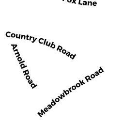
Golfing - areas of land arranged as a golf course (Ch. 61B, not classified as Open Space) owned by CHARLES RIVER COUNTRY CLUB INC - 32 COUNTRYSIDE RD
Single Family Residential owned by SHANG HUAMEI - 30 COUNTRYSIDE RD
Single Family Residential owned by PINKOFSKY STEVEN TR - 391 DEDHAM ST
Single Family Residential owned by SCHEID ANNETTE E - 44 COUNTRYSIDE RD
Single Family Residential owned by SHAMMAY EZRA E - 50 COUNTRYSIDE RD
Single Family Residential owned by MARGOLIS FREDRIC H - 70 COUNTRYSIDE RD
Single Family Residential owned by LESTER DAVID B & LAURA L